
Rooftops Kosciuszko Northern Activities Map
by Rooftop Maps
Original price
$17.95
-
Original price
$17.95
Original price
$17.95
$17.95
-
$17.95
Current price
$17.95
SKU 9781921886317
Our stock is live and accurate.
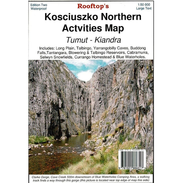
Navigate the northern regions of Kosciuszko National Park with precision.
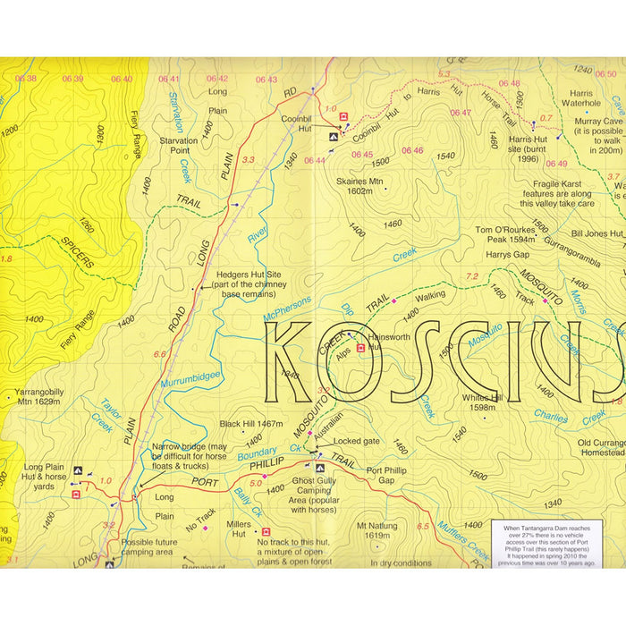
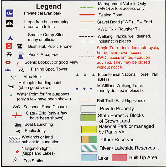
The Rooftop Kosciuszko Northern Activities Map is an indispensable tool for adventurers exploring the area between Kiandra and Tumut. This detailed map encompasses key locations such as Long Plain, Talbingo, Yarrangobilly Caves, Buddong Falls, Tantangara, Blowering and Talbingo Reservoirs, Cabramurra, Selwyn Snowfields, Currango Homestead, and Blue Waterholes. Ideal for bushwalking enthusiasts, it provides comprehensive information on roads, tracks, walking trails, watercourses, bush huts, and topographical contours. Thoroughly field-checked between 2008 and 2010, this map ensures accurate and reliable navigation for your outdoor adventures.
Features
- Coverage of key attractions: Long Plain, Talbingo, Yarrangobilly Caves, Buddong Falls, and more
- Detailed depiction of roads, tracks, and walking trails
- Inclusion of watercourses and bush huts
- Topographical contours for elevation reference
- Field-checked for accuracy between 2008 and 2010
Specifications
- Scale: 1:50,000
- Edition: 1st (2011)
- Publisher: Rooftop's Maps
- Format: Folded paper map
- Language: English